
ICELAND PART 2: THE HIGHLANDS
If you're interested in seeing Iceland, take a look at my 2018 Landscape Photography Workshops
In a country of truly beautiful landscapes, the interior highlands of Iceland offers perhaps the most stunning scenery in the country. Surrounded by glaciers penned in between mountains, it’s a constantly changing alien landscape of black deserts, colourful rhyolite hills, snow-capped mountains, moss covered peaks, crater lakes and plunging waterfalls. After my first trip there 5 years ago whet my appetite I’ve always wanted to go back and explore it more.
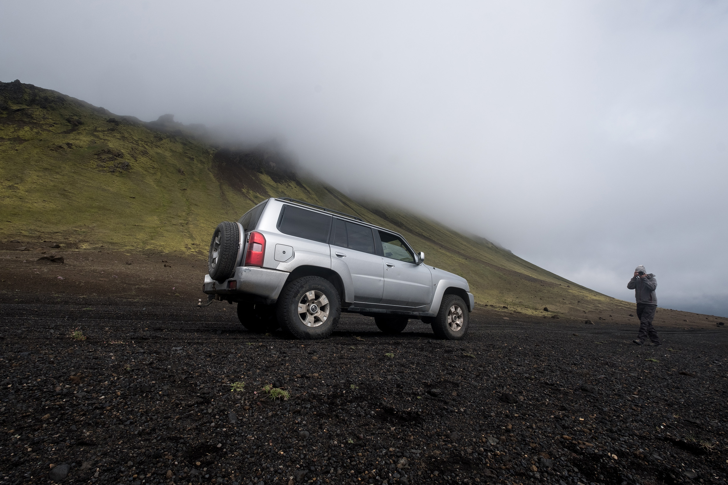
Next year I’m starting running workshops in Iceland and something I’m really excited about is taking photographers to explore this incredible place. Most workshops in Iceland stick to the ring road, not making the journey inland to the highlands due to it’s relative inaccessibilty. There’s no accommodation there so you have to camp along the hiking trails and the only roads are rough tracks with frequent river crossings that require a pretty sturdy jeep. However, myself and two photographer friends, Kostas, Konstantinos, have put together a plan to run workshops to this magnificent area which doesn’t require camping and uses large 4x4s to get clients into the best locations to shoot. But first we needed to scout the locations properly, check the routes and accommodation, and ensure that what we've planned is feasible. Although the workshop will be based in comfortable hotels on the edge of the highlands, we decided to camp on this scouting trip to reduce expenses, as well as combining it with scouting locations for our another Iceland workshop based on the coast and waterfalls.
I’ve outlined our trip around and along the south coast in my previous blog and our first full days were spent exploring the areas around Vík and Reynisfjara before later in the second day we filled our Nissan Patrol up with gas in the town of Hvolsvollur and headed east along the F261 into the valley of the Markarfljót river between the glacier Tindfjallajökull to the north and Eyjafjallajökull to the south. It starts off along good tarmac road, passing fields full of pretty Icelandic horses (one of our workshop bases will be in a ranch here) before turning into a dirt track as we enter the valley proper.
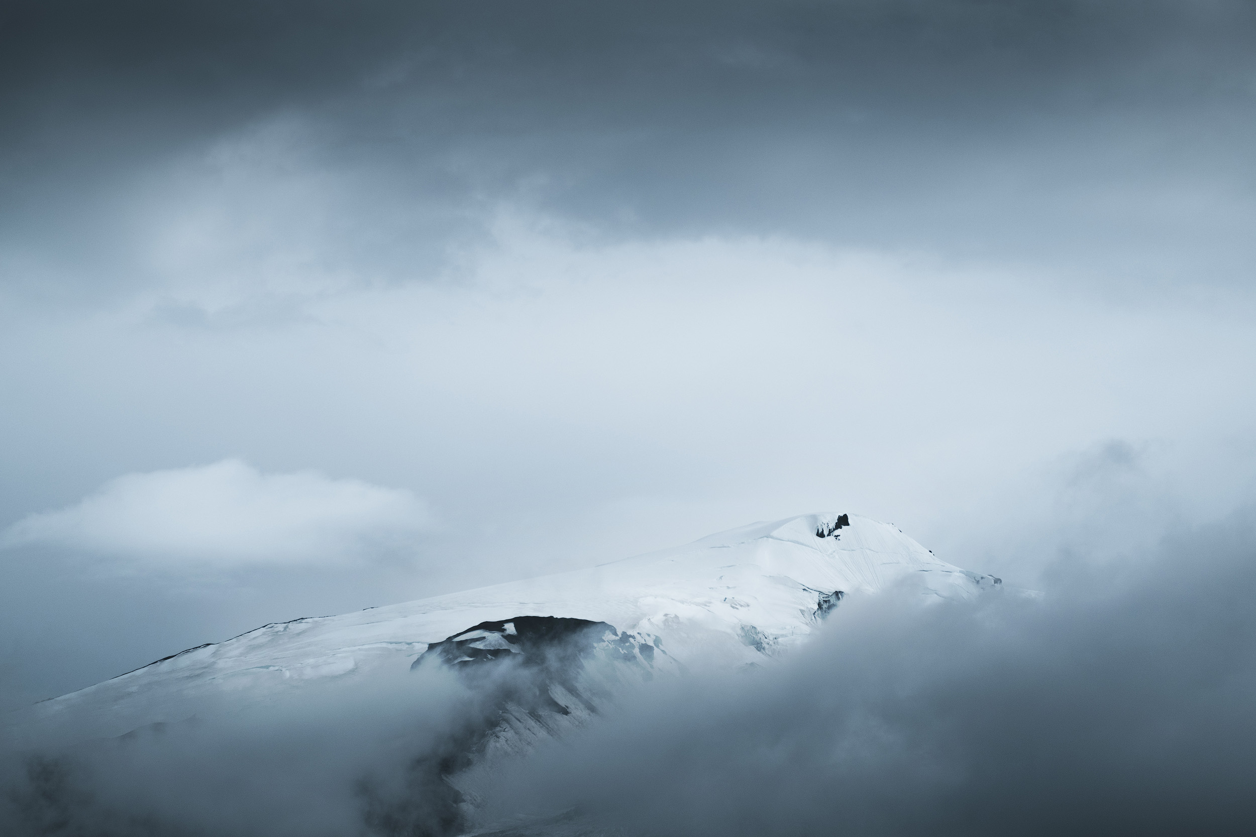
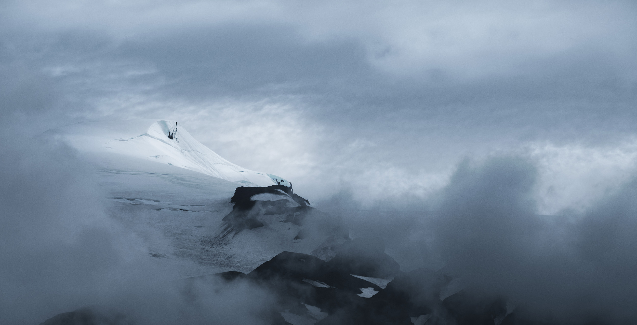
The views to the south in particular are stunning as you can see the snow capped peaks of the Eyjafjallajökull glacier wreathed in cloud, and despite it being in bright midday light we couldn’t resist stopping to shoot it with telephoto lenses
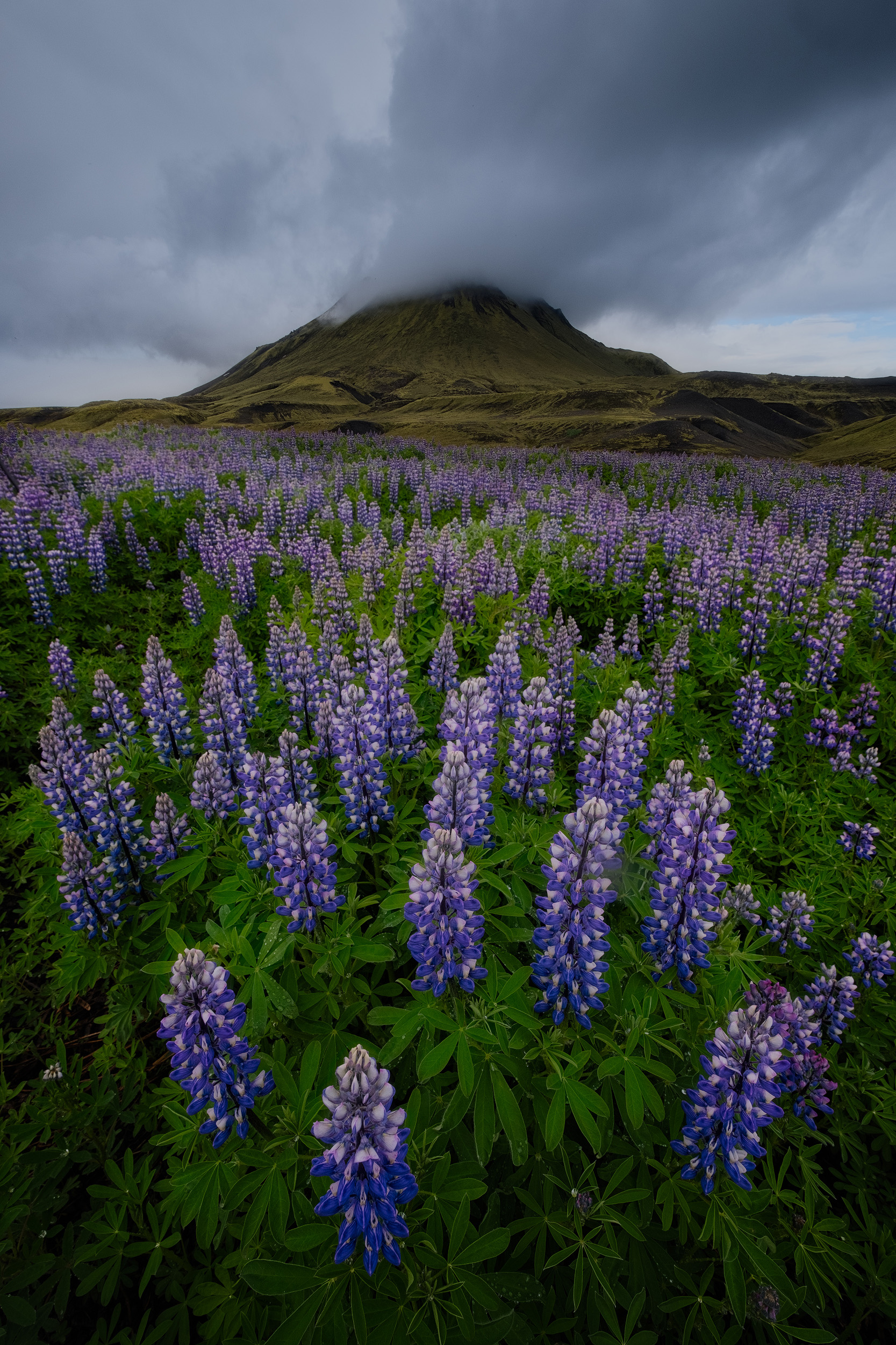
On my previous trip here with my wife 5 years ago we’d managed to get quite a distance along the valley floor, almost to where the Thorsmork hill cuts the valley in half, but we’d had to turn back as the glacial rivers were too deep and dangerous to cross. This time however we had no such problems because not only was the water level much lower than last time, but also in many of the crossings the track has been raised with large pipes carrying the flow of water beneath the road. We made good time and were soon turning north away from the valley floor and into the highlands proper. As you get higher here the landscape changes again, this time to green moss covered plains cut through with rivers. Across to the east we could see the peak of Hattfell and pretty soon we found ourselves in a valley full of lupines. The light was incredibly flat and overcast but we still couldn’t resist getting out and taking a few shots.
As the road continues to get higher and higher to the plain of Hvangill, the green moss gives way to black volcanic desert interspersed with peaks where the green moss still clings along with a patchwork of snow left over from winter. By now it was getting late so after shooting some drone footage at the base of Hattfell we drove around the peak, pitched out tent in Emstrur, then headed back out and up a nearby hill for the sunset. We had a 360º view over the surrounding peaks as we watched the sky turn beautiful hues of pink and purple. I took the shot below facing south towards Eyjafjallajökull.


Then I turned east to shoot a panorama including the volcanic peaks of Stórkonufell, Stóra-Mófell and the Botnar ridge. It’s a fantastic location and an area I want to explore more next time I’m here.
Finally I did some shots facing north to the peak of Hattfell, which was looming directly in front of us. I shot a time-lapse and did some drone shots and then just before the mist rolled in, I managed to grab one final image.
The mist got pretty thick and it was clear that would be it for the rest of the evening so we headed back down to camp. It was a fair bit cooler camping here in the highlands near the glaciers than the previous camp at the coast had been, temperatures dropped to around 5º, but fortunately my sleeping bag is warm enough to deal with this and I stayed toasty all night.
The next morning was cloudy and we headed back towards Hvanngill with the aim of getting to Alftavatn. Every few kilometres we stopped to take pictures of the other-worldly moss green peaks that project from the flat black landscape. The peak of Stórkonufell in particular is incredibly photogenic.
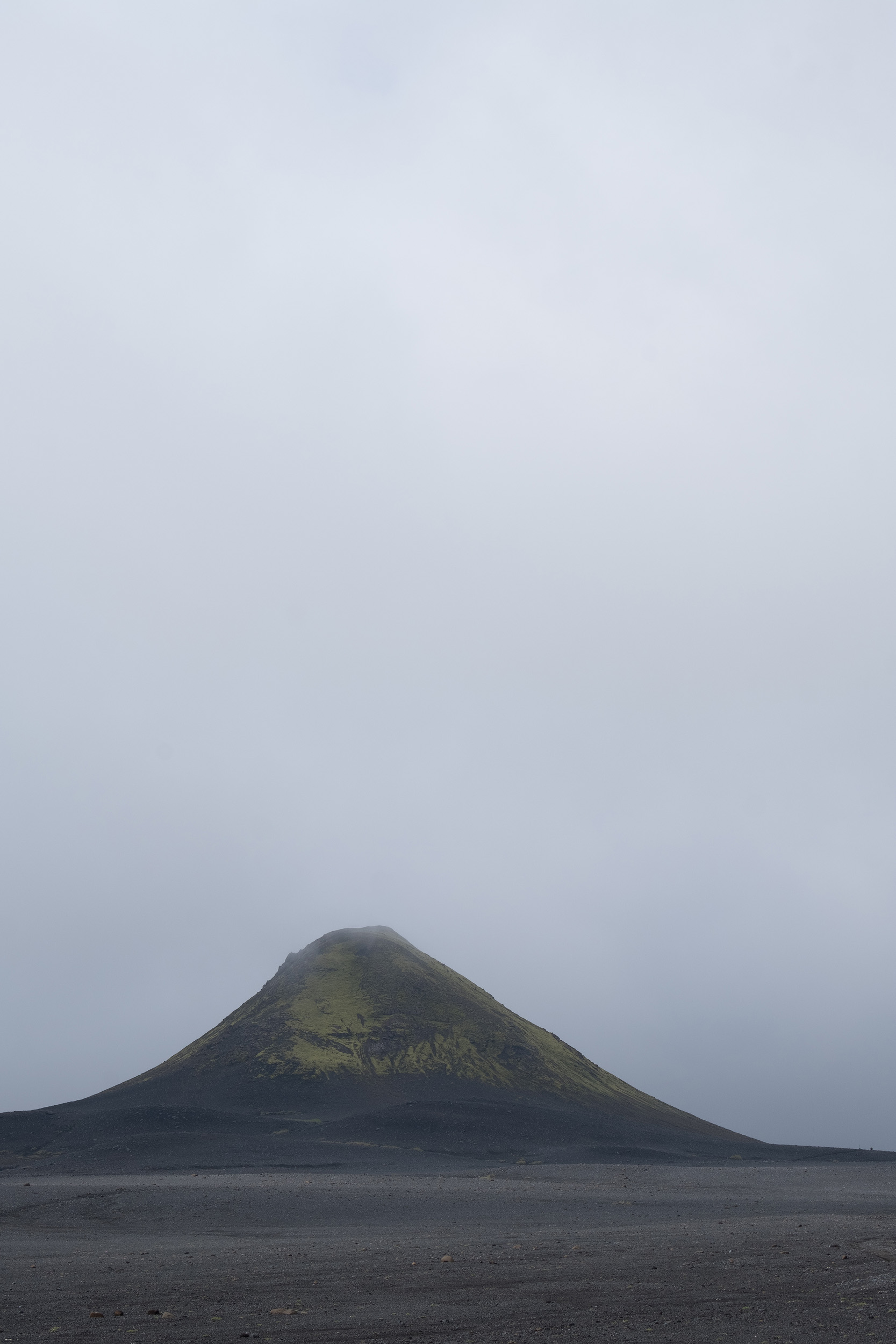
Just before the Hvangill hut the road crosses a particularly deep river. After 15 minutes of debate we decided it wasn’t worth the risk of getting the jeep stuck and we’d be better getting to Alftavatn from th north after we’d visited Landmannalaugaar. So we continued east, this time on the F210 road across the black tundra of Mælifellssandur, the flat volcanic desert at the edge of the Mýrdalsjökull glacier. As we were driving across this lunar-like landscape the mist rolled in again around the time we were passing the almost perfectly conical moss-covered peak of Mælifell.


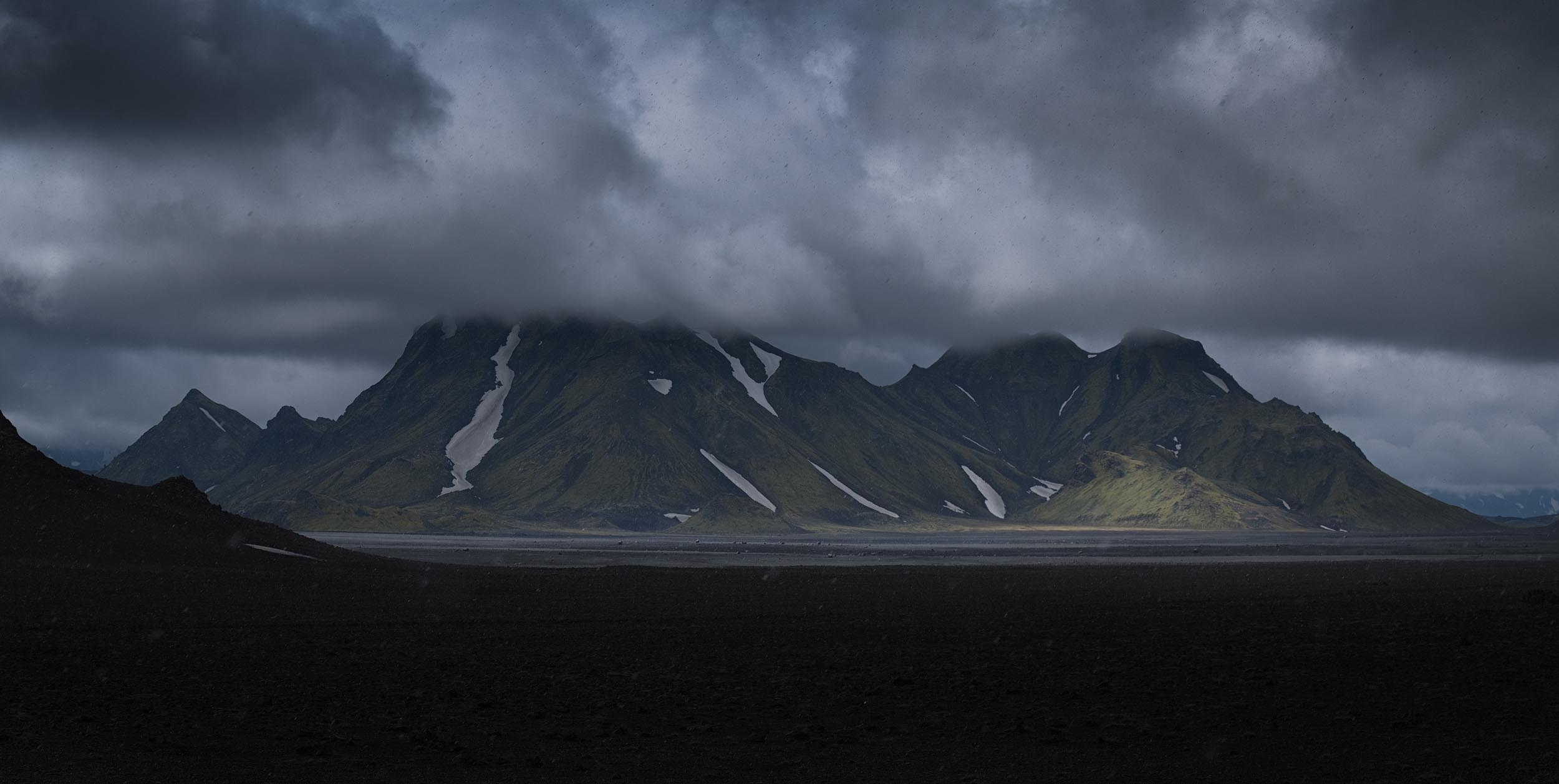
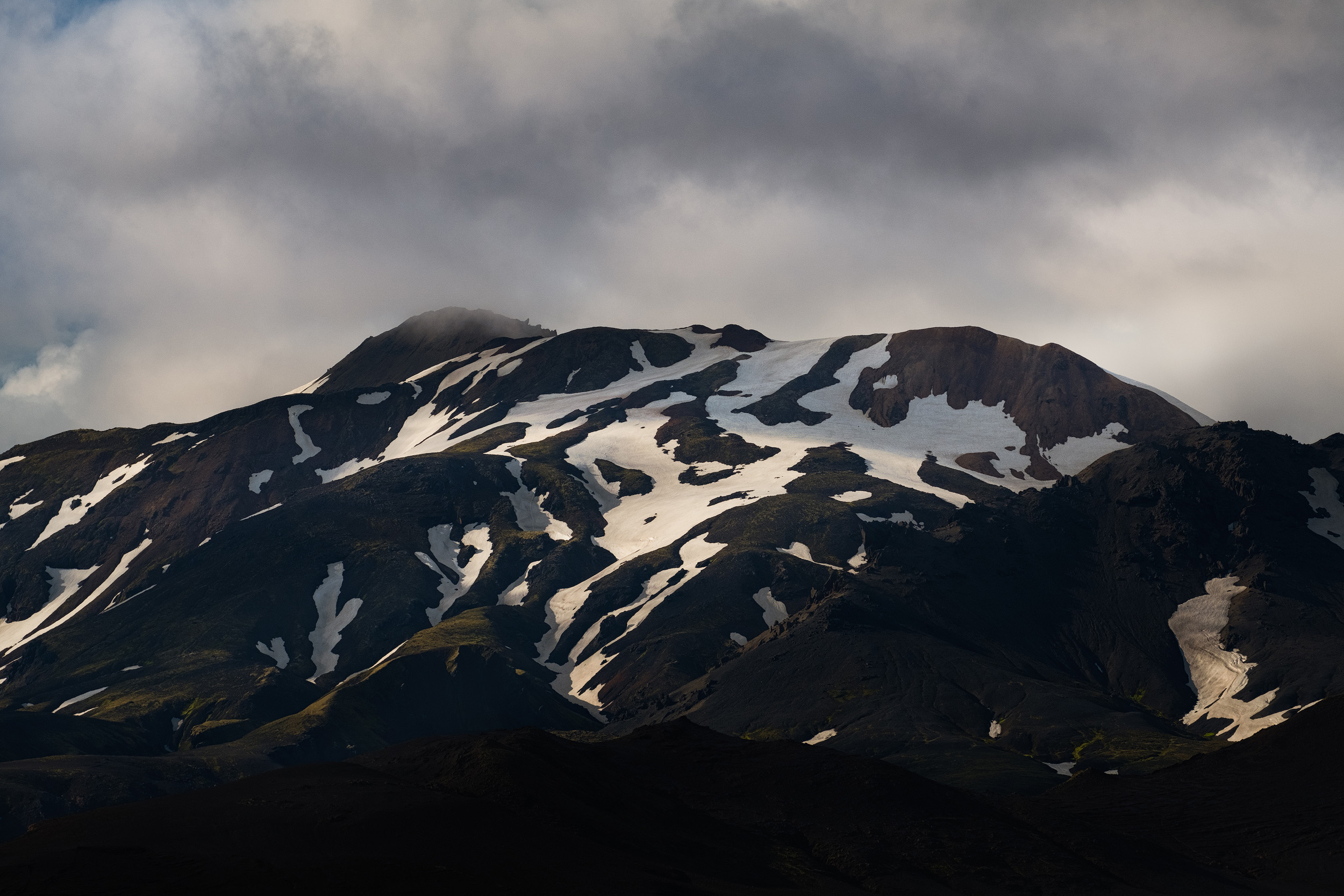
A little later there was a pretty significant river crossing that required walking across to make sure the jeep could manage it. As it turned out, while being pretty wide the river wasn’t particularly deep and we managed it without any problem before turning north on the F233 which would take us all the way to Landmannalaugar. Here we started to leave behind the black tundra like landscape and found ourselves in the more mountainous terrain of the Fjallabak national park. The hills here had far more snow covering them and when seen through a telephoto lens and composed as abstracts, they looked almost like a Rorschach test.
We crossed the river Brandsgil where it leaves the Austurkròkur plain and enters the Landmannalauger valley and spent some time in the lava fields there. Despite the rain and wind I really wanted to use the drone to get some ariel views of the river and it’s different streams and tendrils as it flows across the plain. With the high wind blowing the drone around it was quite tricky to compose, but it was certainly worth trying.


After that we drove across the final few rivers to find ourselves in the Landmannalaugar campsite, which after the relative peace and quiet of our previous days in Iceland felt like we were entering a bustling metropolis. Landmannalaugar is the start (or end) point of the Laugavegur trek and consequently there are always a few hundred people staying there either in tents or the mountain huts on any given day. We pitched our tent on the relatively hard surface of the campsite, tying down the guy lines with rocks, and then cooked dinner. By the time we finished it was getting late and despite the cloud there were some flashes of good light so I headed across the camp and over the embankment next to the river valley to so some shots of the classic view of Landmannalaugar’s colourful rhyolite picked out in golden light, as well as the lower slopes of Blahnukur, the “black mountain”.


By now it was getting late but I was determined to scale the well worn trail that leads to the top of Blahnukur. While it’s not technical, it’s steep in places and the earth is loose so it certainly gets your heart pumping. Kostas and Konstantinos weren’t interesting in climbing it but I was convinced that the views from the top would make it worthwhile so I set off at around 10pm, promising to be back by midnight so we could shoot the twilight elsewhere. This gave me a little more than an hour to make the 400m ascent, so I pushed myself quite hard at the beginning but soon found I wanted to stop to take photos of the valley as a beam of light once again illuminated the rhyolite hills.
I continued up but by now the sky had become very cloudy and I was a little disappointed that I wouldn’t be getting any colour or great light, but even so the views were pretty stunning. I set up and shot some telephoto abstracts of the patchworks of snow on the neighbouring peaks as well as a semi-sunset as the clouds very briefly broke.


It had taken me a little under an hour to get to the top, and then I’d spent around 20 minutes shooting, so I realised I had to start down if I wanted to meet the guys before midnight. Descending may be easier on the lungs than ascending, but it’s certainly harder on the knees and on this loose kind of gravel that makes up the surface of the mountain it’s very easy to slip, so I had to take care. When I was about half way down I started to notice the fantastic patterns in the river valley. The streams coming from the river Jokul looked a little like a tree, so I tried to compose it to look almost like a bonsai growing out of the side of the hill I was walking down.
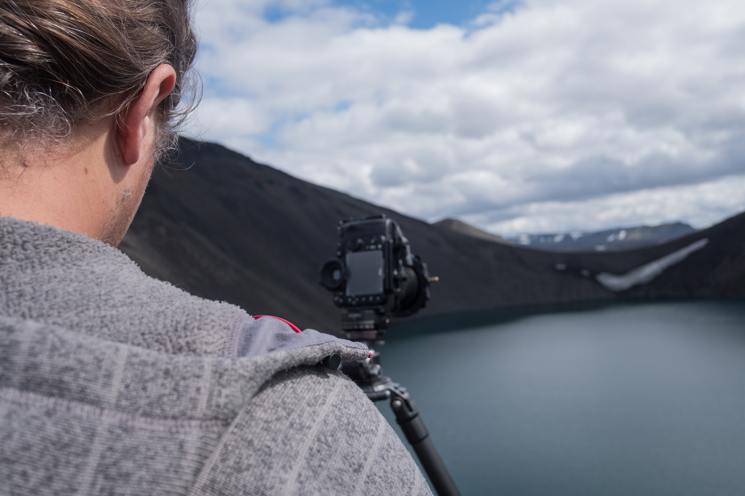
At this point I realised I could see two figures who looked like they were using tripods on the river bed, and from the flashes of white cap I was pretty certain it was my two friends. They gave a nice sense of scale to the abstract shots I took of the valley floor.
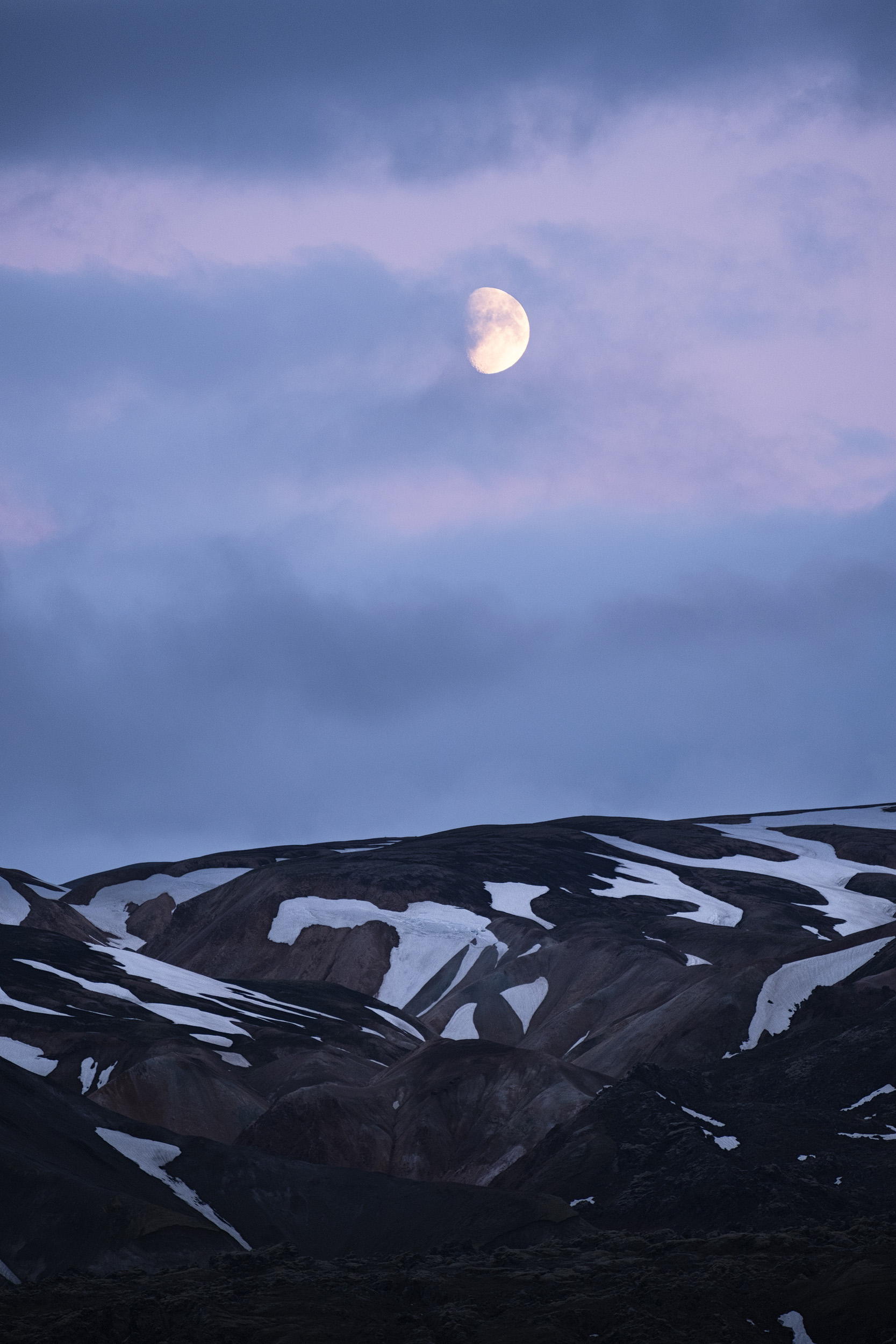
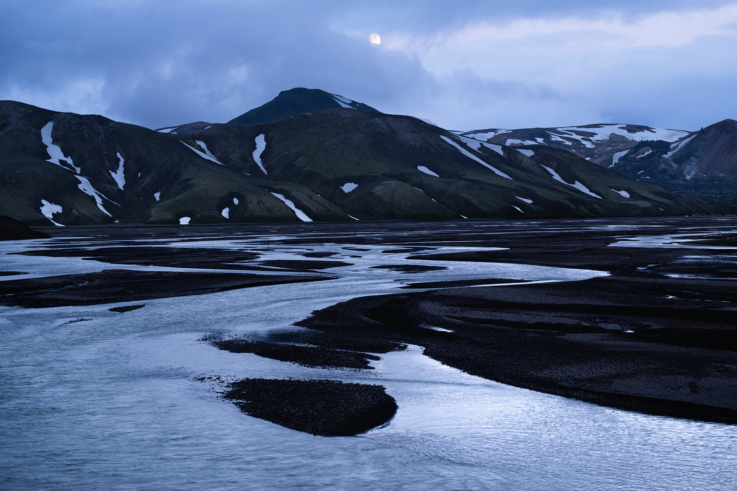
I made it down exactly 2 hours after I'd set off to climb the peak. It was midnight so we decided to head away from the campsite to the next valley over and shoot at Kýlingavatn lake. The light was still flat and it was tricky to get a composition I was happy with, so after getting one shot we headed back to the lava fields at Austurkròkur and shot some long exposures in the blue hour, and also captured the moon rise above Landmannalaugar valley.
After sleeping surprisingly well on the hard ground of Landammanalaugar campsite (mainly due to my Nemo Cosmo 3 inch sleeping pad) we had a shower in the campsite there (of all the campsites we stayed in, the showers at Landmannalaugar are not only the worst, but also the most expensive) before heading north west out of the highlands. Konstantinos needed to charge the batteries of his camera so we planned to make a stop at the Highland Centre, somewhere we were planning to check out anyway as we were hoping to use it as our base for the northern part of the highlands workshop next year. On our way there we stopped off at Hnausapollur crater lake to do some shots, but it was the middle of the day and the light a little bright. It will however make a great location for sunsets on the workshops.

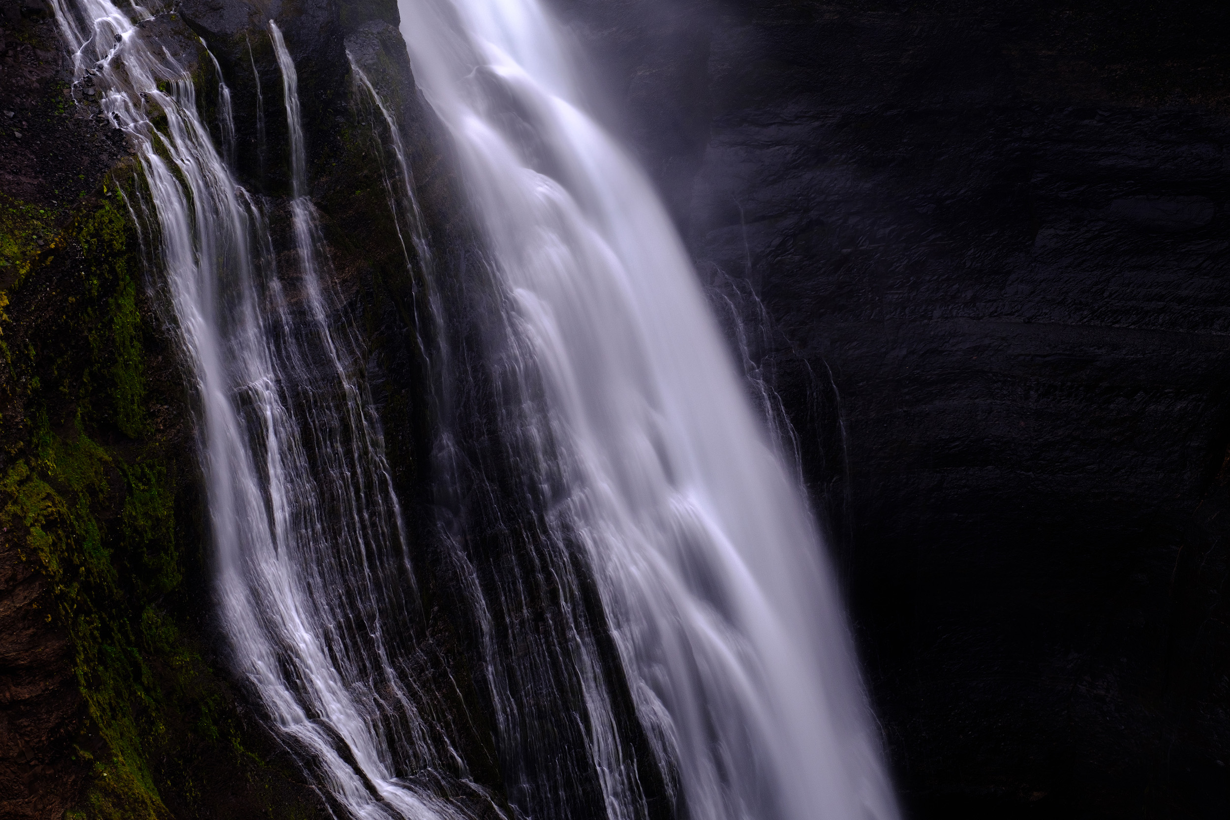
We got the Highland Centre and settled down with some great food while Konstantinos charged his Nikon batteries. One of the advantages of mirrorless cameras like the Fuji is the capacity to charge via USB, which meant my own batteries could be charged via the car or from an Anker power pack. DSLR batteries, whilst lasting longer, are pretty much impossible to charge on the go and so we settled down for around 5 hours before heading out to the waterfalls at Haifoss. It’s a pretty easy location to find and one of the most stunning waterfalls in Iceland. The river splits into two creating two massive falls which plunge 150m to the canyon floor below. The walls of the canyon are vertical and there’s no barrier as you’re out in the middle of nowhere so you need to be careful about going too near the edge. I struggle a little with vertigo but the views here are so incredible that I had to set it aside for 15 minutes while I photographed the waterfalls. As is often the case in Iceland it would have been nice not to have to shoot beneath brooding clouds, but we make do with what we’re given

For the rest of the evening we circled out of the highlands to shoot some more waterfalls and sleep near Geysir before heading back to the southern part where we’d spent our first day with the hope of getting good enough light to be able to photograph the black desert of Mælifellssandur. As it turned out the weather was absolutely terrible and we ended up driving straight through the highlands and heading to the south east coast, just stopping briefly to shoot some images of the eerie thick fog that enveloped the area around Mælifell.
After a couple of nights spent shooting on in the south east of Iceland which I’ve written about in my other blog, we returned to the highland for one last attempt at getting some shots of the Hvangill area in good light. As we turned off the ring road and onto the dirt tracks of the eastern highlands the weather looked very promising indeed.
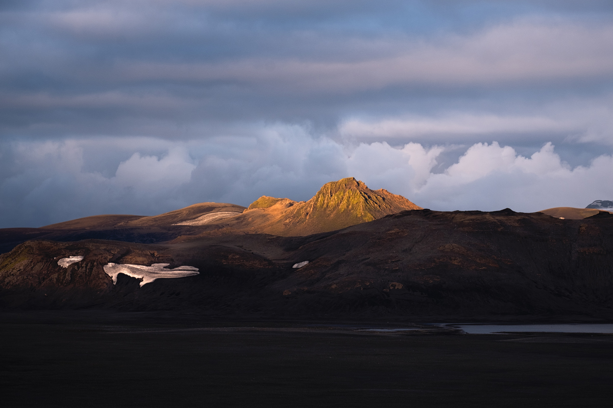
As we got to the area between Storasula and Stórkonufell the light was pretty good and we started to think about where the best location would be to shoot while we prepared dinner. I scrambled up the lower slopes of Utígönguhöftar to shoot a panorama looking north towards the peak of Storasula with the snowcapped mountains of the Fjallabak beyond
We then headed back towards Hvanngill and climbed a small ridge there to have a better view of Stórkonufell, Hattfell and the surrounding peaks for the sunset. Over the next hour we shot continuously as last light of day turned into a lovely sunset above the peaks immediately infront of us as well as above the mountain of Tindfjöll and the Tindfjallajökul glacier. Sitting there, perched on a rock gazing out across this alien landscape beneath a wonderful sky was a genuine pleasure. Not a single living person in view in any direction, nothing built by man, just this ancient and truly stunning vista that reminds us of what the earth perhaps looked like before mankind arrived.
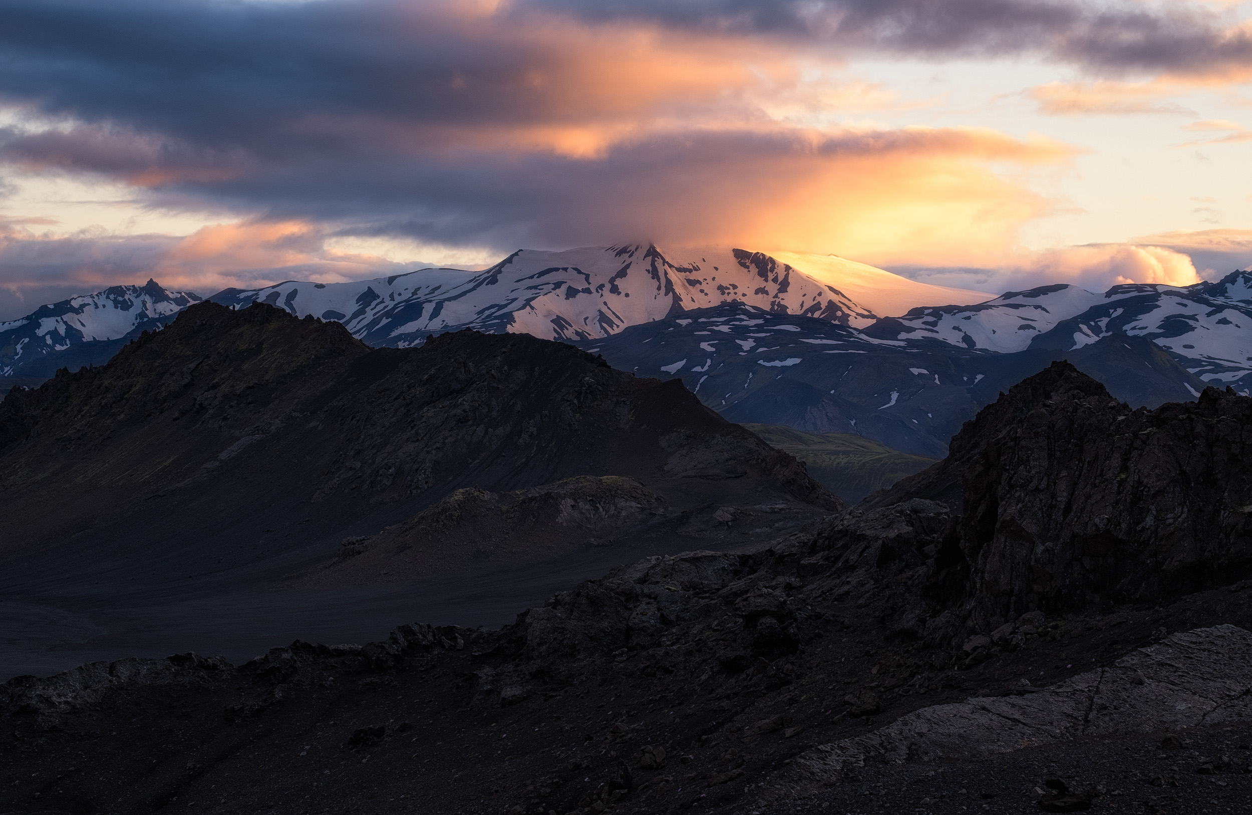
Eventually it felt as though the light had peaked and it was time to tear ourselves away from the view so we headed to Emstrur to where we’d camped on our first night in the highlands. Passing Hattfell there was still lots of colour in the sky so we stopped and ran up the same ridge we’d shot from on that first night and captured the last of the sunset above Hattfell and the pink clouds passing infront of the moon.
Our last night in the highlands was perhaps the coldest with temperatures dropping very low but a little discomfort was worth if for the time we had spent in the highlands, which had proved to be as amazing as I remembered.
We’ll be back next year, and as I write this blog the workshop itinerary is already planned and the accommodation already arranged. We’ll be basing the workshop in two places in really comfortable accommodation just on the edge of the highlands giving us access to both the stunning southern region of Emstrur, Hvanngil, Alftavatn and Mælifellssandur, as well as the northern area of Landmannalaugar and Haifoss. It’s going to be a wonderful journey to some of the most breathtaking and unique scenery imagineable and I’m looking forward to sharing this amazing part of Iceland with a group of enthusiastic photographers next July.
If you’re interested in coming to visit the Icelandic Highlands with me, take a look at my 2018 Landscape Photography Workshops . Alternatively you can sign up my newsletter for more information about workshops
You can see images from all my trips to Iceland in my gallery here.